
Status: Flood Watch
Heavy Rains Forecasted
Friday, May 5, 2017 (9:00 AM)
The Raisin Region Conservation Authority is issuing a Flood Watch for certain areas within the RRCA jurisdiction. Water levels in drains, creeks and rivers are currently high from the precipitation early in the week. We are anticipating another 44 mm of rain over the next 48 hours. This may cause flooding in flood-prone areas along the Raisin River near St. Andrews West, Martintown, Williamstown and Lancaster. The water levels in the lakes in North Glengarry will rise, but are being actively managed. We are expecting continued high outflows from Mill Pond over the next few days.
Peak flows in our region usually occur 12-24 hours after the rain. We are expecting rivers to peak around noon on Sunday.
The RRCA would also like to advise residents that stormwater management infrastructure such as ditches, drains, parking lots and stormwater ponds will be retaining significant amounts of water (which is completely normal). These facilities are designed to hold stormwater surges and release it slowly to the natural water courses. These areas are not intended for recreation as water that is collected may be deceivingly deep.
The RRCA is continuing to monitor the weather and water levels throughout the region and will update this site as necessary.
About Flood Forecasting and Warning in the RRCA
The Ontario Ministry of Natural Resources and Forestry (MNRF) is responsible for flood related emergencies. Flood forecasting and warning has been delegated to Conservation Authorities. If a local emergency is declared, MNRF will work directly with the municipality and in consultation with the Conservation Authority.
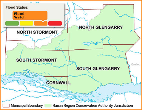
The Raisin Region Conservation Authority monitors precipitation and water levels throughout Cornwall, South Glengarry, and large portions of North Glengarry and South Stormont.
About Flood Forecasting Notices

Normal
No flood conditions exist.

Watershed Conditions Statement - Water Safety
High flows, unsafe banks, melting ice or other factors that could be dangerous for recreational users such as anglers, canoeists, hikers, children, pets, etc. Flooding is not expected.

Watershed Conditions Statement - Flood Outlook
Early notice of the potential for flooding based on weather forecasts calling for heavy rain, snow melt, high wind or other conditions that could lead to high runoff, cause ice jams, lakeshore flooding or erosion.

Flood Watch
Flooding is possible in specific watercourses or municipalities. Municipalities, emergency services and individual landowners in flood-prone areas should prepare.

Flood Warning
Flooding is imminent or already occurring in specific watercourses or municipalities.
In the event of a flood status of anything other than normal, the RRCA will issue a media release and advise our member municipalities.