
Status: Flood Outlook Statement
Flood Outlook Statement Extended
Tuesday, March 17, 2020 (10:00 AM)
This statement is an update to the Raisin Region Conservation Authority’s (RRCA) Flood Outlook Statement issued on March 9, 2020
Water levels around the region are at normal spring melt highs for this time of the year. The current weather forecast indicates 30 mm of accumulated precipitation over the next 5 days. This precipitation combined with continued snowmelt in the upper reaches of the watershed will increase water levels and flows over the next week and may result in flooding in low-lying areas.
Residents should take the necessary precautions to protect their property, such as:
- Ensuring sump pump is clear, in good working condition and has a backwater valve
- Ensuring downspouts are clear and the outlet is as least 3 metres from the dwelling
- Securing items that might float away as flows increase
- Removing valuable items from basements or lower floors that could be subject to flooding
- Keeping emergency phone numbers handy
This statement is in effect until Monday, March 23, 2020. The RRCA will continue to monitor water levels and weather forecasts as part of the Flood Forecasting and Warning program and will provide updates as conditions change.
For more information : Phil Barnes, Project Manager, (613) 938-3611 ext. 240, phil.barnes@rrca.on.ca
Media contact : Lisa Van De Ligt, Communications Specialist, (613) 938-3611 ext. 223, lisa.vandeligt@rrca.on.ca
Forwarded to : RRCA Flood Forecasting and Warning Directory
About Flood Forecasting and Warning in the RRCA
The Ontario Ministry of Natural Resources (MNR) is responsible for flood related emergencies. Flood forecasting and warning has been delegated to Conservation Authorities. If a local emergency is declared, MNR will work directly with the municipality and in consultation with the Conservation Authority.
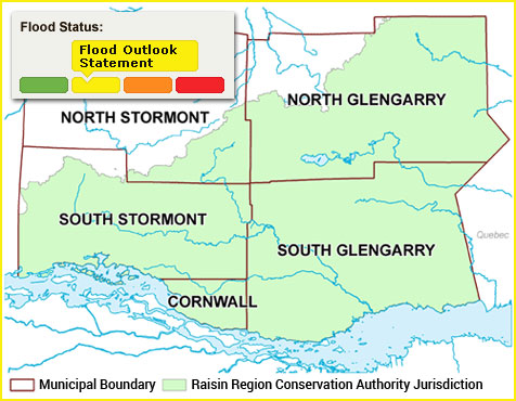
The Raisin Region Conservation Authority monitors precipitation and water levels throughout Cornwall, South Glengarry, and large portions of North Glengarry and South Stormont.
About Flood Forecasting Notices

Normal
No flood conditions exist.

Watershed Conditions Statement - Water Safety
High flows, unsafe banks, melting ice or other factors that could be dangerous for recreational users such as anglers, canoeists, hikers, children, pets, etc. Flooding is not expected.

Watershed Conditions Statement - Flood Outlook
Early notice of the potential for flooding based on weather forecasts calling for heavy rain, snow melt, high wind or other conditions that could lead to high runoff, cause ice jams, lakeshore flooding or erosion.

Flood Watch
Flooding is possible in specific watercourses or municipalities. Municipalities, emergency services and individual landowners in flood-prone areas should prepare.

Flood Warning
Flooding is imminent or already occurring in specific watercourses or municipalities.
In the event of a flood status of anything other than normal, the RRCA will issue a media release and advise our member municipalities.