
Status: Flood Warning
Flood Warning Issued
Friday, April 7, 2017 (11:00 AM)
The Raisin Region Conservation Authority is issuing a Flood Warning. Recent precipitation plus snow melt has caused high-water levels in lakes, creeks and rivers throughout the watershed.
Some rivers have overtopped their banks, and are spilling into the flood plain area. Some low-lying roads alongside Rivers and Creeks may be susceptible to flooding. These areas include:
- McGillvary's Road between Martintown and County Road 27
- River Road, between McGillivary's Bridge and Williamstown
- Cashion Road
- Loyalist Road, downstream of Williamstown
Certain driveways and farm lanes in flood-prone area may also be submerged. Properties upstream of St. Andrews on the Raisin River may also be experience high water.
Water levels are actively being managed for the lakes in North Glengarry. Properties in flood-prone areas downstream of Mill Pond will see water collecting and backing up over the next 48 hours.
Water levels in the area rivers usually peaks 24 hours after a significant precipitation event.
The RRCA is continuing to monitor the situation, and will post updates as required.
About Flood Forecasting and Warning in the RRCA
The Ontario Ministry of Natural Resources (MNR) is responsible for flood related emergencies. Flood forecasting and warning has been delegated to Conservation Authorities. If a local emergency is declared, MNR will work directly with the municipality and in consultation with the Conservation Authority.
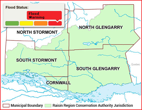
The Raisin Region Conservation Authority monitors precipitation and water levels throughout Cornwall, South Glengarry, and large portions of North Glengarry and South Stormont.
About Flood Forecasting Notices

Normal
No flood conditions exist.

Watershed Conditions Statement - Water Safety
High flows, unsafe banks, melting ice or other factors that could be dangerous for recreational users such as anglers, canoeists, hikers, children, pets, etc. Flooding is not expected.

Watershed Conditions Statement - Flood Outlook
Early notice of the potential for flooding based on weather forecasts calling for heavy rain, snow melt, high wind or other conditions that could lead to high runoff, cause ice jams, lakeshore flooding or erosion.

Flood Watch
Flooding is possible in specific watercourses or municipalities. Municipalities, emergency services and individual landowners in flood-prone areas should prepare.

Flood Warning
Flooding is imminent or already occurring in specific watercourses or municipalities.
In the event of a flood status of anything other than normal, the RRCA will issue a media release and advise our member municipalities.